Feeds:
Posts
Comments

The Dwarf Cypress Stand at Tate’s Hell

By Ric Sitler
 
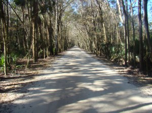
Over the years, probably a half-a-dozen people have told me to go there, so visiting hell in the Florida panhandle –Tate’s Hell State Forrest that is – was an obvious and overdue choice. Five or six arrow-straight dirt trails dissect this coastal swampland creating a large grid pattern. And some of these routes even have names like Dry Bridge and John Allen, the two roads I hoped would lead to my goal, which according to the sign was straight ahead.

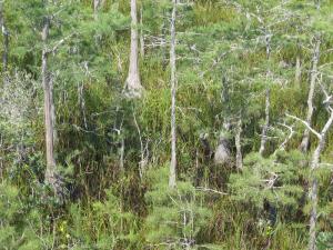
These dwarf trees - some only six feet high - are the main visitor attraction in this part of Tate’s Hell.

Unlike legendary farmer Cebe Tate, I had the comfort of my RV, something in the cooler to drink, and a map of this foreboding terrain bordered to the south by State Highway 98. It was improbable that like ole’ Cebe I’d be lost here for weeks only to eventually exit the swamp screaming my name and proclaiming, “I just came from Hell.”

The brochure claimed this was the only remaining stand of Bonsai or Hat-Rack Cypress trees, which isn’t exactly so. Other mini-cypress samples can be found in the Everglades and many parts of the Big Cypress National Preserve, but these dwarf trees—some only six feet high—are the main visitor attraction in this part of Tate’s Hell.
 
The strange thing is that these trees, some which are 300 years old, are no different genetically from normal full-size cypress trees. Their seeds appear to be the same and when planted in other areas grow to typical full-size trees. Why they flourish as a dwarf species here remains something of a mystery, but it appears to be a combination of soil, nutrients, year-round flooding and a clay-bedrock foundation.
 
Since 1999 a cooperative project involving various state and federal agencies has been underway to restore the natural hydrology of the area and improve growing conditions for swamp grasses and preserve the small trees.
 
As desolate and remote as Tate’s Hell is – more than 202,000 acres  – a handicap access boardwalk provides an excellent treetop view of the swampy miniature tree stand. There’s parking for five or six vehicles, no porta-potties or picnic shelters or water, but hey, this ain’t Disney World. An easy 100-yard stroll takes you to the boardwalk for a panoramic view of the little trees, assorted birds, wildlife and grass-filled brown tea waters. The cypress tree tops below the boardwalk look fuzzy, kind of like a well worn green and gray wool blanket, their twisted trunks submerged in the dark swamp water. If you’re patient…and quiet…you’ll most likely see turtles, a snake or two and an amazing variety of birds.
 
When you return to the parking area, you may spot the site’s one amenity, one forlorn charcoal grill. No tables or benches, just one unipod grill stuck in the ground. Unless you’re absolutely compelled to roast a hotdog here, a better option is get out of Hell and drive into nearby Carrabelle where you can order the fresh catch of the day at Old Salt’s Café & Oyster House just down the street from another mini-attraction, The World’s Smallest Police Station.
 
Freelance writer Ric Sitler is a retired military public affairs specialist and former ad agency writer with an interest in “practically everything except sushi.” His diverse writing and photo credits include Musician, Stars and Stripes, and Old Cars Weekly.


Guarding the Loggerheads

by Emily Young

Sea turtles cry when they lay their eggs. Biologists say it’s their way of shedding excess salt, but Jim Wilson, Fort De Soto Park supervisor and sea turtle steward, thinks it’s something more. “I’m sure turtles have feelings,” he says.

If Jim is right, then a loggerhead hatchling trapped in Nest 30 must be feeling pretty lonely. Her 71 siblings left her behind when they burst from their nest and headed for the sea. With a crumpled right flipper, the tiny hatchling couldn’t follow. She huddles underneath the sand amid a pile of empty eggshells and waits.
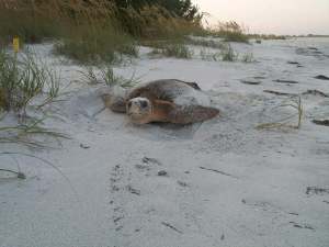
“Turtles have a built-in GPS,” says Fort De Soto Park ranger Jim Wilson. “Like salmon, turtles return to the place where they were born to lay their eggs."

That’s where park rangers come in. Jim Wilson tries to let the loggerhead nests on Fort De Soto beaches hatch naturally, but he can’t help worrying about them. A loggerhead hatchling is shorter than an average kitchen toothpick. They weigh 0.7 ounces. Storms drown them. Fire ants eat them. Ghost crabs attack them as they race across the beach to the ocean. As Jim often remarks, hatchlings are at the bottom of the food chain. He monitors the nests like a protective father, digs out the stragglers, and helps gimpy hatchlings stretch out their flippers. Once the hatchlings leave Fort De Soto, they’re on their own; but as long as they remain on the beach, they’re under his careful supervision.

Today, Jim’s mission is to perform a recovery on Nest 30, which means gathering data on the number of successful hatchings and searching for any stragglers. When most people are just waking up, he’s already busy inspecting sea turtle nests. Shortly after dawn on September 8, 2009, I meet him outside park headquarters.

“Good morning!” Jim sings out. His white hair and beard stand out against his suntanned skin. Dressed in his uniform – khaki shirt, gray shorts and a gold badge – the ranger looks wide awake.

A hatchling is waiting for him.

Jim motions me toward a white truck. “Hop in!” He rolls down the windows and a fresh sea breeze wafts in. Over the water, the clouds are lavender with pink smudges underneath. As we drive along deserted beaches, Jim stares at the thin blue lines of the Sunshine Skyway bridge in the distance. He says he feels sorry for people who cross the bridge on their way to desk jobs.

Some people wouldn’t like getting up at 5 a.m., but Jim likes to check the turtle nests for activity before any visitors appear at the park. We pass a woman walking her black lab near the picnic area. She and her dog come to Fort De Soto early every morning. “Lucky dog,” Jim says.
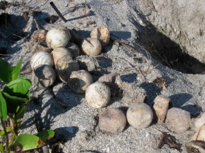
Over 1,000 loggerheads hatched on Fort De Soto’s beaches last year. Rangers recovered another 18 from their nests. One was the tiny hatchling Jim rescued.

On the channel side of the beach, Jim stops the truck for his first nest check of the day. He walks over to a mound of sand, which looks like a small dune. A yellow sign warns visitors not to disturb Nest 38. Bending over, Jim sticks his fingers in the sand to see if it’s soft. He points out the concave area, which he says means “activity.” In other words, some little sea turtles are getting impatient inside their nest. Who wouldn’t feel cooped up after spending almost two months underground?

Turtles are buried alive.

It takes a team effort to dig out. Cracking his shell open with his egg tooth, the first hatchling snacks on the yoke, gathers strength, and waits for his siblings to hatch. Once most of the group hatches, it’s time to climb.

The scrambling hatchlings kick sand into the bottom of their nest, raising the level bit by bit and creating a kind of turtle lift to the top. They wait near the surface until the sand temperature drops after dusk, then pop from the nest and race to the ocean. Strength lies in numbers. If a straggler is left behind, he won’t be able to climb out alone.

For now, Jim is satisfied with Nest 38. On the way back to the truck, he walks past a ghost crab hole and shouts, “Stay down there!”

Ghost crabs are pale: the kind of pale that looks as if it would rub off like too much white powder. At night, they drag baby loggerheads into their holes and eat them for dinner. The next morning, trails in the sand whisper how the hatchling was taken. The ghost crabs’ scuttling sideways gait makes them look even guiltier.

Until they hatch, the eggs inside Nest 38 are relatively safe from predators. When rangers first discover a nest, they put wire mesh over it to keep out raccoons and coyotes. They record the coordinates and landmarks on a nesting form. Three days after the nest is emptied, they perform a “biological evaluation,” or “recovery.”

Nest 30 is scheduled for recovery today, but Jim can’t find it.
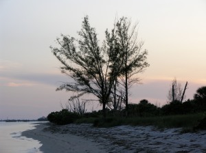
By October, Fort De Soto’s sea turtle season is over, and so is Jim’s role as turtle steward. Next May, the process will start all over again.

He gets out of the truck and searches for it along the beach. Instead of Nest 30, he finds a half-filled water balloon in the scrub. “A balloon!” he says, throwing it in his truck. “They’re really bad. You know what these are mistaken for in the water? Jellyfish.”

As we walk along the shore, Jim describes a juvenile loggerhead’s life in the ocean. In summer and early fall, the Gulf Stream carries floating sargassum weed close to Fort De Soto’s beaches. After hatchlings race into the ocean, they swim 15-20 miles until they reach the sargassum. “That’s their life blood for a while,” Jim explains. The hatchlings cling to the golden algae, eating bugs, worms, snails and barnacles snagged in the weeds. Their camouflaged upper shells, or carapaces, match the green and yellow hues of the sargassum. Safe in their drifting habitat, the turtles spend their early years riding ocean currents around the world. But sometimes a jellyfish or a balloon tempts them to leave their home. “One of these little babies floats by” – Jim indicates the balloon – “and one of the turtles might peel off o’ the grass to get it, and get picked off by a dolphin or a cobia.”

Once the shells of juvenile loggerheads grow to the size of dinner plates, they leave the open ocean to forage in shallower coastal waters. Their size makes them less likely to become lunch. But man-made dangers still claim their lives.

Two years ago, a fisherman on Fort De Soto’s Gulf Pier called Jim for help. He had hooked a sea turtle and cut her loose. It was bad timing. A lightning storm raged over the Gulf of Mexico.

Jim found the turtle struggling in the ocean just off the beach. A stainless steel cable with multiple hooks was wrapped around her body, pinning three flippers. One hook pierced her mouth and another punctured a rear flipper. She fought to keep her head above the choppy waves as lightning flickered across the sky. Rain pummeled the sand. “The lightning was the stuff that was scaring me. It was popping all around us,” Jim says.

When the tide swept her onshore, he set to work. He pushed the first hook through her mouth and cut off the barb, freeing her body from the cable. She raced back to the ocean, pulling Jim along for what he calls a “turtle ride.” Loggerheads can swim up to 15 mph. Jim had just a few seconds to cut the cable and let her go. The remaining hook would rust out of her flipper. Unlike many loggerheads, this one survived her encounter with a fishing line.

Jim doesn’t often get the chance to rescue adult sea turtles. Rescuing trapped hatchlings is another matter. This year, he and the other rangers will search for them in all 38 loggerhead nests at Fort De Soto. Usually it isn’t in the middle of a lightning storm, which makes the process easier.
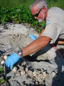
When rangers first discover a nest, they put wire mesh over it to keep out raccoons and coyotes. They record the coordinates and landmarks on a nesting form. Three days after the nest is emptied, they perform a “biological evaluation,” or “recovery.”

But today there seems to be a problem. Jim calls another ranger for back-up.

They get out their tools: a yellow shovel, a hand-held GPS and a Garrett Crossfire metal detector. “Welcome to the wonderful world of turtling,” Jim says. Shovel in hand, he stares at the nesting form like it’s a treasure map and paces back and forth. He gently plunges the shovel into the sand as he walks: scrape, scrape, scrape.

According to the nesting form, Nest 30 is near an osprey pole. There are lots of osprey poles at Fort De Soto. We drive to another beach.

On the way, a Laughing Gull tries to fly across the road, his wing flapping uselessly. Jim gets out of the truck. “Hey buddy, what’s going on with you?” he asks the gull. He catches the bird, deftly.

The gull is quiet as Jim puts him in a cage in the back of the truck. Later he’ll be taken to the Suncoast Seabird Sanctuary. “It’s not just turtling,” Jim says. Saving the birds is just as important as the turtles.

On the bayside of the beach, the rangers finally locate Nest 30 and Jim begins the recovery. He wears blue gloves to protect his hands because he doesn’t want to smell like turtle eggs all day.

He scoops out handfuls of sand until he finds the first egg, which looks like a small white ball. It didn’t hatch. The next egg is in pieces, which means its hatchling is now somewhere in the ocean. Jim looks pleased. His face is bright red from the heat, and beads of sweat glitter on his forehead and neck. Just over his shoulder, the bare branches of a dead Australian pine don’t provide any shade.

He piles the round eggs up like golf balls. The smell is bothering him.

What causes it?

“Rotten eggs.”

But Jim’s next discovery makes us forget the smell.

He pulls out another handful of eggs. A live hatchling wriggles among the broken shells. “We’ve got a turtle!” Jim announces. Her short flippers squirm furiously. Sand coats her dark carapace and she squints against the sunlight.
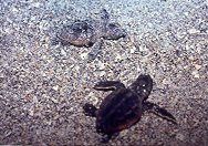
A loggerhead hatchling is shorter than an average kitchen toothpick. They weigh 0.7 ounces. Storms drown them. Fire ants eat them. Ghost crabs attack them as they race across the beach to the ocean.

When I hold her up, she flaps her front flippers as if trying to swim through the air. “She’s been trapped for a while. She’s ready to go,” Jim says.

Nobody knows if the hatchling is a girl or a boy. Warm sand makes girls. Cooler sand makes boys. In-between temperatures yield a mixture. But Jim doesn’t know how hot or cold the sand was when this hatchling grew inside her egg.

For now, Jim decides she’s a girl.

Her right flipper is crumpled – Jim says it has a “giddy-up” in it. He puts her in a sand-filled bucket to stretch. She crawls in circles, her flippers scraping the edges of the container. “That’s the sound we like to hear,” Jim says, happy to have found an energetic hatchling.

The rangers record the nest productivity on the form: 71 hatched eggs, 42 infertile and 7 discernable embryos. One live turtle.

Back at headquarters, Jim places her in a larger bucket and sets a cardboard box on top. She has a long journey ahead, and he wants her to rest before he releases her tonight.

A hatchling’s chance of survival is 1 in 2500. With Jim nearby, this hatchling won’t need to worry about ghost crabs or gulls as she crosses the beach. But the sea has its own set of hazards. “Hatchlings are at the bottom of the food chain,” Jim reminds me, in case we see a large fish snatch her from the ocean as he releases her.

At 7 p.m., the darkening sky is streaked with pink and yellow stripes. Jim takes the hatchling out of her bucket and places her on the soft sand, hoping she’ll scurry into the ocean. She doesn’t budge. After a while, she stretches her long neck forward as if smelling the water. Jim is encouraged. “That’s right! Big strong girl!” he says. He moves her onto the hard-packed sand near the water’s edge.
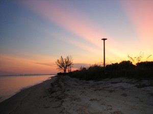
At 7 p.m., the darkening sky is streaked with pink and yellow stripes

She lets the wave wash carry her in to shore, out to sea, in to shore. Jim hovers over her like a father watching his daughter take her first steps. “Come on baby girl,” he coaxes. Finally, a wave drags her into deeper water and she falls to the bottom. Jim yanks off his shoes and socks and wades in. He puts his hand under her and helps her take a breath. After all, he just rescued her from starving. He’s not about to watch her drown.

He takes his hand away. The hatchling flaps her flippers and propels herself to the surface. In the clear water, it looks like she’s flying. Her head pops up. Her tiny mouth opens. Bubbles rise as she gulps in a breath of air.

She is exhausted from the effort. Jim fishes her out of the water and points out her carapace. The sand has washed away, revealing the green and yellow shell underneath.

She is dressed for sargassum grass.

But the hatchling isn’t ready for her grassy home yet. Jim takes her back to headquarters so she can rest before beginning the 20-mile swim to the sargassum weed. If she is too weak to swim away, she may live the rest of her life in captivity at the Clearwater Marine Science Center.

Three hours later, at 10 p.m., Jim gives the hatchling one more chance. He covers his flashlight with a red lens, knowing sea turtles can’t see red, so she won’t be distracted by the artificial light. She needs to navigate by the light of the moon. This time, the hatchling crawls to the water’s edge and hesitates for a second before scurrying into the ocean. An outgoing tide sweeps her away. Twenty meters out, she surfaces to take a breath, a speck in the middle of the ocean. Jim watches her come up once more before she vanishes underwater.

The rest of the journey is up to her.

By October, Fort De Soto’s sea turtle season is over, and so is Jim’s role as turtle steward. Next May, the process will start all over again. “He’s a true steward of the environment,” says Terry Tomalin, the St. Petersburg Times Outdoors and Fitness Editor. “Having someone at Fort De Soto who truly cares and has a personal stake in the turtle population probably makes a difference in the percentage of turtles who hatch and make it to the sea.”

Over 1,000 loggerheads hatched on Fort De Soto’s beaches last year. Rangers recovered another 18 from their nests. One was the tiny hatchling Jim rescued. If she survives to adulthood, Fort De Soto will see her again in 15 to 30 years. “Turtles have a built-in GPS,” Jim says. “Like salmon, turtles return to the place where they were born to lay their eggs.” Thirty years from now, Fort De Soto’s beaches won’t be cluttered with condos. Hatchlings who return as adults will see the same stretch of beach they left as babies.

A ranger will be waiting to watch over their eggs.

Emily Young is a freelancer who enjoys writing anything – whether features or fiction – if it makes for a good story. She has lived on Florida’s Gulf Coast her entire life and has never seen snow. She is currently completing an undergraduate degree at the University of South Florida. For a glimpse into Emily’s world, visit her blog, The Essential Emily.
Clara Barton was Here 

by Emily Young 

The radio in the motor boat is stuck on the chorus of “Everybody Dance Now.” It blares as if we’re in a dance club instead of Egmont Key, a remote island in the Gulf of Mexico. The other tourists don’t seem to care. They eat jumbo-sized Pringles and play catch with “Life Is Good” Frisbees. Is life good? Maybe if nobody else had discovered Egmont Key. Maybe if, as I’d hoped, I could have appreciated nature without these distractions.
 
It’s June, the day before Father’s Day. My dad and I almost miss the 11 a.m. ferry from Fort De Soto to Egmont Key, arriving just in time to buy two $20 tickets and find a seat beside the 26 other passengers. Since we don’t have a boat, a ferry is the only way to access Egmont Key, a 1.5-mile-long strip of land at the mouth of Tampa Bay. Beyond it lies the gulf.

“We come back at 1:30 and 2:30,” the gray-haired ferry captain announces over his loudspeaker. “Repeat after me: 1:30 and 2:30. Don’t be late. If you’re late we let the other passengers do whatever they want to you.” Missing the ferry could mean spending the night on a deserted island, where there’s not even a trickle of freshwater and the only shelter is in the darkness of old ruins. The captain flicks on the radio and it starts playing “One is the Loneliest Number.” I silently vow not to miss the ferry. 

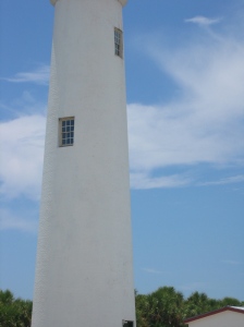
The lighthouse ... seems part of the land, gleaming white against the sky like bleached bone.

As our green and yellow vessel leaves Fort De Soto, the other passengers ooh and ahh over the tour-guide spiel. The 30 minute ride brings us gradually closer to Egmont Key, an abandoned island inhabited only by protected wildlife. If not for the motor boats anchored off the island’s shore, we might have been traveling back in time to unsettled Florida. 

Sometimes I agree with nineteenth-century naturalist John Muir, who yearned for places where “no mark of man” spoils nature – places where nobody blares their radios on the beach and drowns out the rhythm of breaking waves. But not every mark of man destroys. I’m traveling to Egmont Key to seek the marks of history, of almost-forgotten peoples whose stories are still buried in the sandy soil and salt water of this island. These haunted human landscapes are even more precious than empty, unspoiled nature: through them, we connect to the people who lived here before us, which in turn connects us to the land. 

This island is haunted. I can see it in the distance, a fringed line of scrub and palms. The lighthouse beckons our ferry closer. It seems part of the land, gleaming white against the sky like bleached bone. There are many bones around Egmont Key. The bones of ships are sunk offshore, the skeletal ruins of old Fort Dade crumble on land, and the remains of soldiers and lighthouse keepers and Seminole prisoners are buried under the sand. When our ferry docks, a flock of seagulls hovers over the scrubby island, where vine-choked trees twist skyward. The birds are “unearthly” in their beauty, like the sandhill cranes Gloria Jahoda describes in “River of the Golden Ibis.” Early explorers wondered if the graceful cranes were the spirits of a ships’ crewmen killed by pirates. Visitors should be warned – this is an unearthly sort of place. While most of my fellow passengers sun-bathe on the beach, I search for Egmont Key’s forgotten ghosts. 

Following the red brick army roads, my dad and I cut through the heart of the island until we reach the gulf beach on the southwest side, near the bird refuge. Here, the U.S. Army’s power plant, once built in the center of a thriving island during the Spanish-American War, is now a pile of crumbling cement on the beach. It looks like a giant’s child built a house of blocks and knocked it over. Felled palms are scattered among the rubble like huge toothpicks. The sea trickles into the ruins, making little afternoon tide-pools that shimmer in the sun. We decide to swim. Floating in the water, I discover a barnacle-encrusted septic tank several feet offshore that looks like an abandoned well. As the waves diminish the island bit by bit, the power plant is shoved farther into the sea, and the gulf reclaims it. After swimming beside the building that once powered this island community, I want to see the ghost town itself – even if that means leaving the coolness of water for the sweltering interior. 

Here, the U.S. Army’s power plant ... is now a pile of crumbling cement on the beach.

Egmont Key is hot. We’ve been walking along this brick road for an hour, but it feels like days. A grasshopper catapults onto my back. A fuzzy caterpillar plops onto my leg. Thousands of caterpillars have invaded the island, inching up the lighthouse as if it’s Mount Everest and dropping unexpectedly onto us from every palm tree. As if the caterpillar invasion isn’t enough, I cut my toe on a slab of cement covered with green slime, and now I’m bleeding. My water bottle is running low. But when I stop complaining, I wonder what the island was like for earlier people. Sick soldiers from the Spanish-American War were once quarantined here, nursed back to health by the famous Clara Barton. She later wrote with polite horror that Egmont Key would have been a lovely island except for the “gnats, mosquitoes, sand fleas, snakes, and daily storms.” In other words, she hated it. 

With Clara Barton’s words echoing in my head, a scrubby island suddenly becomes a place rich with stories. I understand how writer and conservationist Susan Cerulean feels when she praises the power of these “storied” landscapes. “The real stories of Florida are so powerful … that if we were to somehow reclaim them … things would be very different,” she writes in her essay “Restorying Florida.” What she meant by “very different” is an increased appreciation for our wild places: history turns sticky, buggy Florida nature into something transcendent. Through Egmont Key, Clara Barton and I have something in common. 

As I walk along the ghost town, where crumbling cement steps lead to invisible houses, I feel connected to the vanished people who lived here before. A white egret strolls along the red brick road, taking long strides, bobbing its thin neck. It looks like a smug gentleman dressed in a white summer suit with yellow galoshes, out to visit his friends. Only egrets, seagulls, and tortoises walk this way now – even most bikini-clad tourists keep to the familiar beaches. But these roads that cut with military precision through the island once united a small town, which boasted electricity, tennis courts, and movie theatres during WWI. My dad obligingly holds my blue beach bag embroidered with pink sequined fish while I walk around the tennis court, imagining it in its glory days. I can almost see the trim young soldiers in white tennis shirts and regulation trousers, lobbing the ball back and forth across the net. Now it’s just a slab of concrete in the middle of the scrub. Egmont Key has a rich military history. During the Civil War, rebel blockade runners slipped past the Yanks, who were ever-watchful on their island outpost. Some unlucky Confederates were caught and imprisoned here. Theodore Roosevelt and his Rough Riders watched this island fade into the distance as they sailed to Cuba during the Spanish American War. Today, I trudge the same soil Teddy marched. 

Australian pines reach skeletal branches to the sky and decapitated palms stand like sentries – a lonely place.

There are no ruins on Egmont Key to commemorate the Seminoles’ stay here. That dark portion of Florida’s history is blotted out. But the island remembers. The captured Seminoles – warriors, women, and children – were “penned like cattle” in a stockade, writes Gloria Jahoda in “River of the Golden Ibis.” They might have been cattle waiting for the slaughterhouse, for all their captors cared, but they were really waiting for deportation. “If suddenly we tear our hearts from the homes around which they are entwined, our heart strings will snap,” the Seminole chiefs pleaded. I whisper Seminole words, probably mangling them badly, but wondering what they might have sounded like when this island was filled with prisoners. A gopher tortoise scampers down the road towards his burrow. Yok-che, turtle. Within the heart of the island, away from the motor boats, the landscape hasn’t changed much since Seminoles were here. These palm trees and wildflowers, Numpagalaale laknalon, were probably their final glimpse of Florida nature. Egmont Key was the last sight of their beloved Gulf Coast, before they were crowded onto freighters bound for New Orleans, and finally the West. Three thousand Seminoles passed through this tiny island, which was the first stage of the aquatic Trail of Tears. Many died before they reached their next destination, and some died – of their snapped heart strings? – before they left Egmont Key. A mass of darkening storm clouds builds over the gulf, and I wonder how many imprisoned Seminoles gazed out over this same stretch of water. 

As the sun rises higher overhead, walking in the Florida brush becomes unbearably hot. We switch to the beach, strolling along the sand at the edge of scrub. Near the bird refuge on the south side of the island, the vegetation suddenly dies out, as if ravaged by fire. Australian pines reach skeletal branches to the sky and decapitated palms stand like sentries – a lonely place. Dad checks his cell phone and realizes it’s already 1:30. We turn around through the scrub, heading back towards the ferry, but the lonely feeling stays. 

Sometimes the land’s link to the past is so strong it scares people. Haunts them. They see things here. Since the 1970s, park rangers have heard someone whistling “Dixie” in the twilight. They’ve seen platoons of rebel soldiers standing guard, shadowy shapes moving along the old fort. One park ranger swears he saw a Civil War soldier walk four feet in front of him, then vanish into the darkness. I look for rebel ghosts, but I don’t see anything. That doesn’t mean I don’t hear things. Inside the skeleton of a mine storehouse, wind rattles against crumbling concrete. Except there is no wind. Walking along the road the soldiers built, I hear something rustling in the scrub beside me. But nothing is there. Train tracks lead to nowhere, finally disappearing into the sand. Sunlight burns my face and shoulders, but underneath a canopy of Sabal Palms, everything is dark. Almost creepy. Dead palm fronds scrape each other – scritch, scritch. If Egmont Key is really haunted, I understand why. It wasn’t always a tourist destination. For some people, it was a nightmare. 

They say you could hear the screams from the shore. At night, it was too dark to see the island, but the cries were audible. It was 1898, the end of the Spanish-American War. Wounded soldiers sailed from Cuba, expecting medical care once they were quarantined on Egmont Key. But no one was ready for them. The doctor was away in Tampa, and a storm wrecked the hospital tents, sending the soldiers back to their unsanitary ship, the Santiago. It was August. The sun pounded the ship, where the men had no proper food or sanitation. All they could do was scream. Four died. Their bodies were buried in the lighthouse cemetery, never more to leave the island – maybe left to haunt it. 

Time is running short, and my dad and I have to meet the ferry before it leaves us stranded here. But we want to see the lighthouse graveyard before we go. Thirty mounds in the sand. Thirty plain white crosses. Thirty lumps of jagged cement before each unmarked grave. I look at these mounds, and think about the bones of Seminole Chief Tommy, and the six-month-old baby a Seminole mother laid to rest, and all the young American soldiers who died on the Santiago. An American flag flies over all the graves, even the Indians’. The stories buried in this place are so strong that sometimes, when there is no one else around and wind whispers through the trees, I can hear the voices of those who came before. 

Emily Young is a freelancer who enjoys writing anything – whether features or fiction – if it makes for a good story. She has lived on Florida’s Gulf Coast her entire life and has never seen snow. She is currently completing an undergraduate degree at the University of South Florida. For a glimpse into Emily’s world, visit her blog, The Essential Emily.

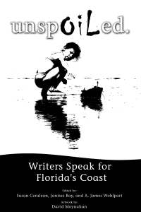
Unspoiled. Writers Speak for Florida’s Coast  is a new anthology that reminds Floridians why our state needs to retain its ban on offshore drilling: to protect our environmental and economic interests.

Unspoiled.,  spawned before the April 2010 oil spill in the Gulf of Mexico, compiles 38 essays by writers, scientists and students, including paddleandpath.com’s Edward C. Woodward, who describes a day with his daughter revisiting an AmeriCorps beach nourishment project.

You can learn more about the anthology’s origin in an interview with co-editor Susan Cerulean. Proceeds benefit the Red Hills Writers Project.

Awakening Days at Dead River

by Edward C. Woodward

With his jeans rolled up to his knees, a dog at his side and a flat boat to pole about, Ron Yates had a carefree smile in a September 1960 photograph. A few days earlier, Hurricane Donna had swept through Florida and up the U.S. East Coast, causing $387 million in property damage.

 But for a young boy with a boat, flood waters meant fun. 

Dead River Road in 2010

 The photograph was taken at Dead River, a secluded weekend village northeast of Tampa named for a branch of the Hillsborough River. The community sat at the confluence of the Hillsborough and Dead Rivers. 

Yates, a south Tampa jeweler, recalls that flooding there wasn’t unusual. But after Donna, the water rose so high that Yates and the dog appear to be poling across the Hillsborough River. The caption explains: “Ron Yates is poling from “Pa” Corbetts (sic) back yard to Yates’ back step. This was the height of the flood.” 

 Dead River was populated by more sabal palms than people. About a mile downstream from Hillsborough River State Park, it had fewer than a dozen masonry block and wood frame homes, all two miles from the nearest paved road. They were getaways for a policeman, carpenter, rancher, and jeweler, among others. They sometime-residents came from Tampa, Zephyrhills, and rural Hillsborough County. 

Donna, however, would be a catalyst for closing their private retreat. The hurricane followed heavy spring flooding. For four days in mid-March 1960, 27 inches of rain soaked West Central Florida. “Worst Flood Batters Tampa Area,” proclaimed the front page of the The Tampa Tribune. An accompanying photograph shows a boy standing atop a submerged car in Town ‘N Country. 

Within six years of Hurricane Donna, the Southwest Florida Water Management District, a new state agency, began acquiring property to help prevent the kind of flooding seen in 1960. The part-time residents of Dead River were forced to either sell their homes to the state or lose them through eminent domain. 

By 1981, the 17,000-acre Lower Hillsborough Flood Detention Area would double as a densely wooded recreation site for a booming region. During the same period, the Tampa Bypass Canal was built to divert Hillsborough River floodwaters from the cities of Temple Terrace and Tampa to McKay Bay. 

About 20 years ago, Dead River was improved as a park to be maintained by Hillsborough County. Razed homes and four decades of forest growth have camouflaged clues to its past life. A clearing with an elevated view of the Hillsborough River suggests a gathering spot, but a fish camp that beckoned boaters, swimmers, and fishermen is long gone. 

In roadside woods, an abandoned John Deere tractor that once graded an unpaved road and freed stuck cars is now a makeshift planter: four-leaf ferns and moss sprout from its front wheels. The memories of Dead River’s homeowners and weekenders, however, fill in the gaps. Zephyrhills resident Craig Miller frequented the fish camp as a teenager. There he dove from a giant sweet gum tree into the Hillsborough River, or trapped “big ‘ol stink pot turtles,” in wire-mesh cages. The turtles became water scooters for Miller and his brothers. Shells were handle bars, the animal’s strong legs motors. “They’re just going like mad and you can … turn ‘em up, down, dive with them … use them like a scooter,” Miller recalled. The rides lasted as long as 20 minutes or, Miller confessed, “’till the turtle’d get tired.” 

Betty Yates Garton recalled getting stuck in the mud on her way home from the beauty shop. Garton had to leave her mother and baby son in the car and trudge two miles to Dead River. And it was all the fault of her husband, Arthur. He was supposed to call her if the access road was impassable. “I walked all the way from [Highway] 301 down to the road, across the bridge, and Ronnie [her son Ron] saw me, and he said, ‘Dad, you won’t believe. Mom’s coming across the bridge and she is mad as hell. And guess what, she just got a new perm and … she’s got all little ringlets all over it.” 

Since the early 1980s, two resident rangers have revived family life at Dead River. Lester Truman, who manages Lithia Springs Park, had a veritable zoo, where he cared for and rehabilitated animals, often showing them at schools. “You name it I pretty much had it out there,” Truman said. Most – except the snakes and bobcats – roamed free. “They stayed close to the house. They knew where the food was.” 

When Jack Coleman succeeded Truman at Dead River, he recalled someone doubting his ability to cope with the isolation. But a secluded park is Coleman’s briar patch – he grew up in a Massachusetts state park on the outskirts of Boston. “Someone said I wouldn’t last two weeks, and I’ve been here 20 years.” 

During the unprecedented 2004 hurricane season, Coleman and his family split their time between Dead River, where they preferred to stay, and their church’s annex when county officials asked them to evacuate. Coleman had his green sconce hurricane candle holder, the same one he used during Hurricane Donna when it hit his Massachusetts home post-Florida more than 45 years ago. Little did he know that Donna would indirectly sustain his livelihood in the woods by helping turn a private enclave into a public park. “I think this [Dead River] has been a great extension,” he said. “Now I’m actually living here longer than the park I was born and raised in.” 

Edward is co-founder and editor of paddleandpath.com

Casting fore hits and hazards

By Paul Abercrombie

We crouch, tiptoeing with cartoonishly exaggerated slowness toward the water’s edge. Our extreme stealth is only partly about not spooking the fish. We’re mostly hiding from the guy in the golf cart cruising by barely two fly-rod lengths away this misty early morning.

You see, my pal Scott Borders and I are fishing on a golf course. Or rather, on water hazards. The things that golfers try to avoid.

Yet as the Tampa trial lawyer and I land and release a dozen hefty largemouth bass over the next hour, I can’t help wondering: Are we the only ones who know what great fly-fishing can be had on golf courses?

Well, yes and no.

Everyone knows that, as the tourist brochures claim, Florida is a golfer’s and fisherman’s paradise. Fewer seem savvy to what great fly-fishing there is on the Sunshine State’s umpteen golf-course ponds. These Lilliputian lakes, infrequently if ever plied by anglers, often hold lunker largemouths as well as more-exotic species. Judging from the number of fly fishermen I’ve spoken with who admit to haunting water traps, our ranks appear to be growing.

What’s more, ours may be the ultimate recession-time sport-fishing experience.

Consider that chasing bonefish in the Florida Keys can set you back a few grand. You’d be lucky to hunt redfish by boat for a third as much. But to fly-fish golf-course ponds, you need neither a boat nor a guide nor, for that matter, even a tee time.

What you often do need is a willingness to bend — okay, break — a few rules.

Fishing is forbidden on many of Florida’s private and public golf courses, though some will let you dip a line if you ask nicely. Of course, a ban on fishing all but screams: “Lots of big fish here!” Not that rules deter most anglers hooked on golf courses. Scott’s lawyerly advice for those caught rod-handed: “Run like hell.”

Which Scott and I are fully, if sophomorically, prepared to do this midweek morning as we work a pond on the fifth hole of the course at a private golfing community (whose identity I’m withholding to protect the guilty) located 15 minutes north of downtown Tampa.

We’ll start fishing here, Scott explains, not only because it’s a good spot (he once pulled a seven-pounder from this pond) but because it’ll take the day’s first golfers a while to reach us. Many players don’t mind sharing a course with fly fishers, but all it takes is one complainer to ruin the fun. A golfer himself, Scott packs a two-piece rod in his club bag. “It’s my 15th club,” he jokes.

After tying black bug poppers to our lines, we space ourselves about a quarter-turn of the pond apart and start casting, aiming for clumps of submerged grass and other likely cover for bass.

Manicured lawns and few trees may make for nearly snag-free backcasting, but fishing golf ponds has its challenges. Especially for a guy who grew up fishing for trout in bramble-lined Northeastern streams.

So I soon discover, after Scott’s bug disappears with a loud slurp. A brief fight and Scott has landed our first fish, a nice three-pound bass. He’ll catch several more, and bigger ones, before I get my first, a puny bluegill.

By the time we see another human — a groundskeeper driving a golf cart, who spies us and gives a friendly wave — I’m starting to get the hang of it. I’m doing as Scott says — bringing line in with short, constant tugs, to make the lure stutter across the water’s surface — when I realize it’s gone with a gulp. I somehow remember Scott’s advice to “strip strike” rather than “trout strike” the line by giving it a good yank first to set the hook before raising the rod tip. After a brief but satisfying tussle, I’ve landed and released my first links-bound largemouth. About two pounds and, tallying the number of casts, a par 37.

We move on to a pond on the sixth hole. Scott is hauling them in four or five to my one. As we fish, Scott shares more tips on how to catch golf-course fish and how to avoid being caught fishing. Among the lessons for the latter: In general, it’s best to start on the back nine in the morning, reversing the order if fishing at dusk, because many golfers will be finishing up on the last holes or will already have headed to the bar. Also, if a club lets in only those with reserved tee times, simply set a tee time, then cancel it by cellphone after you’ve cleared the guard shack.

Above all, watch out for the golf course rangers, officials who travel the course, tactfully encouraging poky players to speed things up and otherwise helping golfers. Common at courses without caddies, they can be the outdoor equivalent of mall cops itching to make a bust.

Soon, with the sun rising and golfers on the horizon, Scott and I head back to his SUV, parked in the driveway of relatives who live in this community. From Scott’s high-wattage smile, you’d think he’d just pulled plump rainbows from the Deschutes River below Oregon’s snow-capped Mount Hood (he has) or won a tug-of-war with a bonefish in the Bahamas flats (dozens of times).

“We just caught some really nice fish. And all before going to work,” he says. “It’s hard to have a bad day at the office after that.”

If you prefer your links fishing sanctioned, visit the Ritz-Carlton in Orlando, which runs a G. Loomis-sponsored fly-fishing school on its golf course. Here, master instructor Ben Stein will help work out casting kinks and give you a chance to put your lessons to the test on 44-acre Shingle Pond.

A recent visit left me with an improved single-haul cast and a greater appreciation for the quirks of my newest piscatorial passion.

Deftly piloting us in one of the school’s three Hyde drift boats, Stein reaches out and stays my casting arm. “No sense even trying,” he says of the small submarine of a fish I’m eyeing. A longnose gar, its toothsome jaws will make quick work of my 12-pound test leader.

An avid Florida golf course angler while growing up (he neither confirms nor denies more recent adventures), Stein says it’s not uncommon to find yourself pulling against saltwater species such as young tarpon, which find their way to the ponds via interconnected waterways. That’s not counting the more exotic non-native species, pets dumped by owners or escaped from fish farms.

And then there are other golf course hazards. The lake we’re fishing is home to water moccasins and a dozen or so man-size gators. “You can see why we require guests to fish with a guide,” Stein says with a laugh.


Paul Abercrombie, a publicist and writer based in Tampa, is author of Organic Shaken and Stirred(Harvard Common Press).

Litter-ary Tease

Be a river deFENDER. Pick up and paddle.

Litter-ary Tease

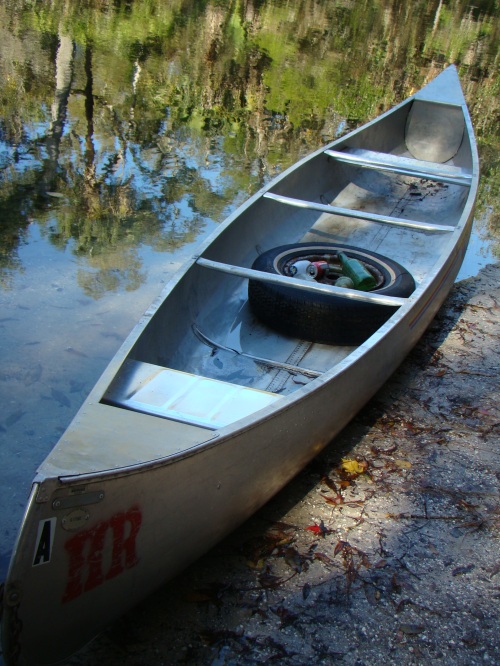
DSC04349How to Fill a Tin Canoe: pick up and paddle.

“… all this abstract fooling around we do now just ain’t satisfactory. That’s why people act so silly. If there is no point to what you do, you might as well become a consumer.”

– Robb White, author of How to Build a Tin Canoe

Rare is the book that reveals itself before it begins. But read Robb White’s disclaimer in his boatbuilding and exploration memoir “How to Build a Tin Canoe,” and his voice is clear: “None of these stories is true … not a single word. If you think you recognize yourself in any of these fictitious characters I talk so bad about, that’s just your own paranoia. There is no point in suing me anyway. Because of the nature of the boatbuilding business, I don’t own anything at all, and if you decide to take it out on my ass, just remember, you got to bring some to get some.” 

Early on, White, who died in 2006, details building a tin canoe like the one he fashioned from a chicken house roof as a child reared in the “Red Hills” region of south Georgia during World War II. Some passages read like a conversational manual that might interest boaters more than others. But try not to skim these parts. White’s no nonsense writing style makes it worthwhile with snippets about shaping tin such as, “Do it in your backyard so you won’t attract too much attention (this is a one man project . . . you don’t want no destructive supervision.)”, and “Don’t let yourself get frustrated and frantic … hell, man, tin is cheap.” You realize White’s lifelong affection for his childhood boat when he writes, “I seldom build a boat that turns out all that much better than those tin canoes.”  
The coastal flats of Florida’s panhandle were rich exploring grounds for White and his cousins, who roamed the waters and woods unsupervised. There White and crew ate oysters and “angel wing clams as big as Coca-Cola bottles that lived in holes so deep that the excavations we left in the flats became landmarks.” White shares acute observations about tidal species, including the unusual relationship between the toadfish and the pistol shrimp. In a simple yet profound tone, White says of those summers: “You know, taking the whole summer off to go to the coast wasn’t all that unusual in the Deep South back before megalomania and AC.” 

White’s storytelling, advice and opinions aren’t confined to exploring and boatbuilding. “I think that, like hunting and subsistence farming,” he writes, “fishing for a living is a natural thing for people to do and all this abstract fooling around we do now just ain’t satisfactory. That’s why people act so silly. If there is no point to what you do, you might as well become a consumer.” And his rant against digital clocks made me laugh aloud. However, White, whose sister is author Bailey White, thrives as a storyteller. I won’t spoil or dilute his gems by paraphrasing them, just entice you with the elements of one story: a shower curtain, the Mississippi River and King Tut. And it takes place in New Orleans. Have fun.

– Edward C. Woodward

The Beaten Path

By Grant Donaldson

Author’s note: The Absaroka-Beartooth Wilderness in Montana is not a high value tourist attraction because it is overshadowed by Yellowstone National Park next door, but its beauty and majesty rival that of even Glacier National Park. It is considered a private treasure by many Montanans.

I was standing outside my snug cottage on the banks of East Rosebud Creek in south-central Montana watching a storm front roll off the Absaroka-Beartooth mountain range 15 miles to the southwest. Thirty minutes later the cauldron enveloped my little valley. The temperature dropped 30 degrees. Snow and rain reduced visibility to zero and the downdraft of wind off the mountains exceeded 100 miles per hour, leveling evergreen trees in neat rows.

I retreated to the security of my sturdy cottage and experienced another typical late-September Montana snowstorm.

Absaroka-Beartooth Wilderness

Absaroka-Beartooth Wilderness

The battering of the wind on the windows reminded me of another experience on the top of that same mountain range a few years earlier in which the only protection between nature’s wrath and myself was a thin layer of nylon tent fabric. I was hiking with my co-worker and friend Rod Plowman and we had stood at the base of the Clarks Fork Trailhead  near Cooke City off Highway 212 in our hiking shorts, boots and backpacks, ready to embark on a six-day hike across the largest plateau above 10,000 feet in the lower forty-eight states.

We were most concerned with grizzly bears and had our bear spray canisters in our hands and revolvers strapped to our thighs as we stepped into the silent forest. But we would soon realize that bears were the least of our challenges. The standard backcountry joke is that the spray is for the bears; the revolver is to be used on you if the spray fails.

We’re Florida boys, unaccustomed to the steep grades of the mountain west and we were determined not to be one-upped by Montana locals who glided up and down the grades with the ease of mountain goats. For weeks we had both trained in our own way to get fit. The workouts would prove beneficial but hardly sufficient for the abuse our bodies were about to endure.

One day after work I had spied Rod striding down Tampa’s yuppie promenade of jogging political correctness (Bayshore Boulevard) clad in hiking boots, shorts, and a backpack full of bricks. He was oblivious to the multicolored, Lycra-clad joggers streaming past him.

I had spent my training time on the steep stairs of Plant Hall, a historic landmark on the campus of The University of Tampa. We were both confident of our lower body strength as we started up the gradual grade ascending the Plateau. And we were comforted somewhat by the trail description of the Beaten Path: “long and strenuous, but not technically difficult or dangerous.”

Absaroka-Beartooth Wilderness

Absaroka-Beartooth Wilderness

Rather than doing the sensible thing and hiring a guide, we had stubbornly decided to navigate with a “topo” map, compass and a few pages of the hike description from the Falcon Guide series. The ubiquitous Falcon series covers almost every trail in the West with accurate descriptions from author Bill Schneider who seems to have personally hiked most of them during a long career.

I had toured the Absaroka-Beartooth Wilderness by car via Highway 212 a few years earlier and I was vaguely familiar with some of the trails that laced the plateau. I offered Rod two options. We could drive from Red Lodge, MT to the top of the range in Wyoming and take a series of trails that would lead us back to the car, or we could take the Beaten Path that would terminate on the northwest side of the range at East Rosebud Lake  in Montana where we would be more than 100 miles from the car with no way back.

With a predictable indifferent shrug Rod picked the Beaten Path route that would take us over 26 miles of the most spectacular mountain scenery in the lower U.S., featuring remnants of ice age glaciers, hundreds of fish-filled alpine lakes, unnamed waterfalls and the state’s highest mountain at more than 12,799 feet, Granite Peak.

We were both tired of Tampa’s horizontal glut of traffic, general congestion, heat and job stress and we longed to withdraw, if just briefly, to a few days of basic essentials like sleeping, eating, and walking in the company of our friend Jack Daniel’s.

Bourbon was our weightiest commodity but we were willing to bear the extra poundage in our backpacks.

Long distance trekking is all about the weight you carry. Unlike many specialties that produce useless products, the backpacking industry has miniaturized almost everything. High tensile tents that protect you in a gale have been reduced to three or four pounds. Tiny gas-powered MSR cook stoves weigh just ounces and will cook food for several people. A folding saw is essential. Sleeping bags must be light but warm at zero or below. A lightweight water filtration pump is a must to protect you from Giardia lamblia that has infested even the alpine water sources thanks to the introduction of livestock grazing.

Absaroka-Beartooth Wilderness

Absaroka-Beartooth Wilderness

A tube of toothpaste can feel like five pounds by the second day. Two pair of shoes: one to wear and one to dry. Jeans are heavy and don’t dry easily. “Cotton kills,” goes the saying. And it’s true in more ways than one. Lightweight, lined polyester and nylon shells dry fast and protect against the cold. A roll of toilet paper ranks up there with bourbon, and the carrier of this commodity is given special deference.

Even with careful planning, we were never able to get our packs below about 60-70 pounds and we’ve suffered the consequences many times at 10,000 feet in thin air with our legs burning and lungs screeching.

As we made camp in a box canyon about 1,000 feet below the plateau rim that night, we got our first taste of changeable Montana weather. Within minutes the sun blotted out, temperatures dropped, a mixture of rain and snow descended. The thunder was like the constant roar of a stream in snowmelt, amplified as it rolled around the walls of the small canyon. The savagery of it made you feel naked in your flimsy tent. Whole trees were blown off the sides of the cliffs and came crashing down. The next day we would be exposed to the full force of the summer weather on the open plateau.

The following morning we saw splinters of trees and entire trunks on the ground, but no fire.

As we broke camp we stumbled over the putrid carcass of a winter-killed moose not 20 yards away and out came the bear spray again.

Ahead of us was a steep 1,000-foot climb of switchbacks to the undulating plateau above the timberline. The Absaroka-Beartooth Wilderness alone is 943,377 acres, but it is contiguous to the Yellowstone and Wind River ranges that stretch 100 miles to South Pass, WY, that comprise more than 5-million acres of wilderness. The Beartooth Wilderness is so large it creates its own weather. In summer, the high plains can be baking under searing-dry heat for 100 miles in any direction and snow and rainstorms will be raging in the Beartooth with temperatures in the 20s and 30s.

Absaroka-Beartooth Wilderness

Absaroka-Beartooth Wilderness

It is one of the world’s largest hydrological machines, spewing water out through nine major drainages to the thirsty desert year round.

After we topped the rim of the plateau on the second day the going was easier. Lichen covered rocks and fields of wild flowers poked through the snow patches and a relatively gentle 20-knot breeze kept the mosquitoes at bay unless you stopped in the lee of a scrubby tree. The mountain mosquitoes are gentle compared to Florida’s saltwater variety that provoke instant flailing. These cold weather cousins just sit there and drink until you run your hand over them. Their bite is hardly worth noting.

The literature says the Beaten Path and its network of trails can swallow a thousand hikers. We saw only three or four parties in our six-day crossing and all but one party were day hikers at either end of the trail.

We were grateful for the one party that had preceded us because they broke trail through a two-mile field of knee-deep snow along the edge of Fossil Lake, the highest elevation of our trek. Even at 10,000 feet, the peaks still towered above us. One end of Fossil Lake flows into the Rosebud drainage of Montana. The other end connects to a lake chain that feeds the spectacular Clarks Fork of the Yellowstone that flows east onto the Great Plains of Wyoming and north into the Yellowstone River of Montana.

We set up camp on a dry spot beside Fossil Lake the second night in anticipation of a trail dinner consisting of a brimming pot of macaroni and cheese sauce, topped off with candy bars and hot coffee with a splash or two or more of Jack Daniel’s. Freeze-dried soups, pasta, rice and other condensed foods sound ghastly back in urban society but they are epicurean delights when your life has been reduced to the essentials of food and shelter.

The Montana night sky at 10,000 feet glows with luminescence that appears to be obscured by dust clouds until you realize the clouds are actually shoals of stars and galaxies whirling through space. The magnitude of it humbles the soul and reminds you of your insignificance.

I crawled from my tent the next morning to see a plume of black smoke rising into the clear, still Montana sky. The source of the plume was our campfire as Rod incinerated a pair of heavy black boots he had been lugging for three days. The scene would have driven a Sierra Club member into seizures but Rod had carefully weighed the amount of the environmental damage against the strain on his back and arrived at a logical conclusion. He was pleased with himself.

Absaroka-Beartooth Wilderness

Absaroka-Beartooth Wilderness

Most afternoons we were chased by sudden soaking rain and snow flurries, high winds and swollen streams. We learned that Gortex-lined waterproofed boots are of little value if the stream depths exceed the height of the boot. So we sloshed along, absorbed in the knowledge that we were seeing pristine country as it was when Lewis & Clark came through in 1803.

We had saved the best for last, which is why we had started at the Cooke City end of the trail. As we tipped over the northwestern side of the plateau at the Fossil Lake outlet we descended through a nine-mile canyon of thunderous waterfalls, each one spectacular in its own way. And each one, had it been located back east, or nearer civilization, would be a major tourist attraction.

We camped amidst the roar, tried to dry our boots and finished off the last of the Jack. “No Trace” camping is the rule out West, a concept that seems to have escaped the Eastern hiking mentality. During six days along the trail we had picked up a single crushed beer can that had perhaps fallen out of a saddlebag.

The trail terminated at a deserted campground and a community of cabins built around deep, clear East Rosebud Lake. Unfortunately, we didn’t realize that we were still 20 miles from the nearest paved road. There was one occupant in the state campground. But he was packing up and offered to drop us at the small community of Roscoe, home to the famous Grizzly Bar and its platter-sized steaks, gigantic hamburgers and inexhaustible quantities of beer.

Satiated with the glories of red meat and beverage, we stumbled down to Highway 78 with our gear, which was now becoming burdensome. An early model Ford LTD the size of a yacht cruised by in the opposite direction, turned and stopped next to us. It was driven by a mid-fortyish piano teacher on her way to a lesson but she would be happy to take us 20 or so miles into Red Lodge where we could find beds, showers and food.

Montanans are famous for their generosity to fellow travelers. A cynical friend of mine says it’s because people know that if they don’t lend assistance, especially during the winter, the stranded traveler could be dead from hypothermia in an hour. I have witnessed a car go over an embankment and within 10 minutes there are half a dozen cars and pickups stopped. Ropes, shovels, and chains come out to assist and within minutes the driver is either back on the road, on the way to a hospital or at least out of the ditch.

Grant Donaldson nears Cooke City

Grant Donaldson nears Cooke City

After a night on clean sheets and a soak in a hot tub in Red Lodge it took us two more rides to get back to the rental car. The first was with a young man and his kids and dog, towing a boat who stopped to let us pile into the truck bed on top of his camping gear. A family from Iowa on their way to Cooke City took us the rest of the way to the car.

We would be back in Tampa before it dawned on us that the headaches, dizziness, extreme exhaustion and sense of motion that we experienced for days afterwards were all symptoms of altitude sickness. Maybe it was better that we didn’t know. But it wouldn’t have changed our plans anyway.

The author is an outdoor writer who has fished and hiked the remote reaches of Florida and the Western states for 25 years. Grant Donaldson can be reached at: Stillwater2007@verizon.net